Preparing CALMET GEO.DAT for any location
The CALPUFF modeling system meteorological processor is CALMET. The geophysical properties of the CALMET modeling domain are specified in the GEO.DAT file. This contains the landcover and terrain elevation values for any gridpoint of the domain.
CALMET comes with the geoprocessors CTGPROC (for the landocover) and TERREL (for terrain elevation). Their output files are then provided to the preprocessor MAKEGEO that creates the GEO.DAT file.
There are several sources both for landcover and terrain elevation. Some of these have a global coverage, while others have a regional coverage.
For landcover, two global datasets are MODIS at 500m resolution, downloadable from NASA's AppEARS, and Copernicus Global Land Operations Vegetation and Energy (CGLOPS-1) at 100m resolution. At regional level there are the CORINE 2012 landcover at 100m resolution for Europe, and the National Land Cover Database 2019 (NLCD 2019) at 20m resolution. Another dataset for North America (USA, Canada and Mexico) is Landsat 2010 by CEC, at 30m resolution.
An exhaustive review of available datasets can be found in the open access book Land Use Cover Datasets and Validation Tools.
The standard datasets for terrain elevation with global coverage are SRTM3 (Shuttle Radar Topography Mission) with 3 arc-second resolution and SRTM1 with 1 arc-second resolution, both available form USGS's Earth Explorer. An alternative source for SRTM3 data is CGIAR website.
The format of these datasets is typically TIFF and they come in tiles, so that it may be necessary to elaborate these files to obtain an input for CTGPROC and TERREL. Usual operations include subsetting and merging the tiles. This can be done using tools like gdalwarp. The extraction of values in the TIFF files to prepare the CSV input to CTGPROC can be done with gdal_translate. The documentation of the landcover datasets allows to create a conversion table to be input in MAKEGEO to convert original values in CALMET categories.
See this post for some details in the procedure.
As an alternative, we can prepare the GEO.DAT file for you for any location. You can ask for a quote here.
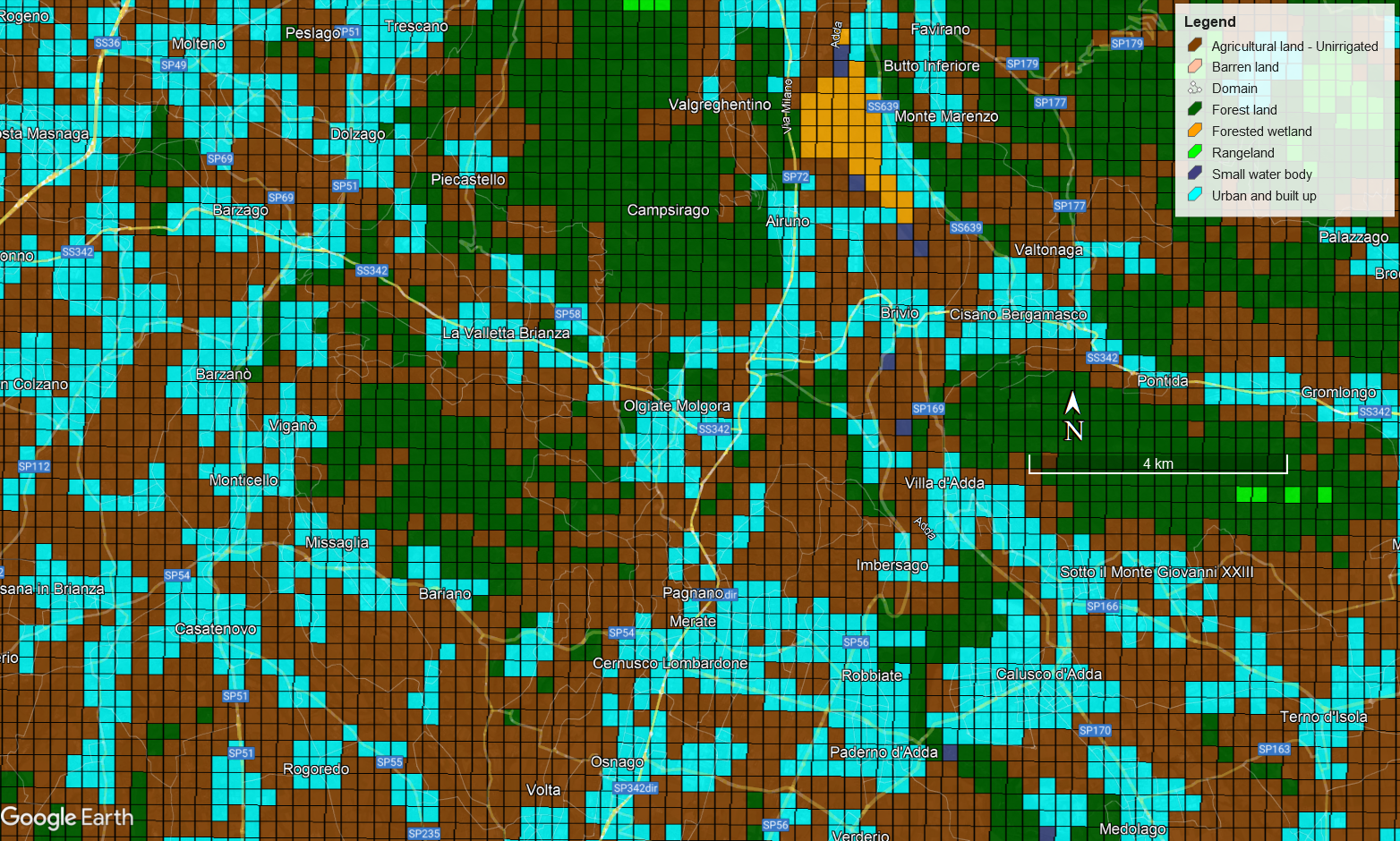
This Google Earth grid plot showing a high resolution landcover was created with GEPlot.
Order GEO.DAT and meteorological data for CALMET, CALPUFF, LAPMOD AND AERMOD