Using CALPUFF with a single station meteorological file
The preferred meteorological preprocessor of the CALPUFF dispersion model is CALMET, which is capable to provide time varying 3D fields of wind and temperature, and 2D fields of other important variables such as Monin Obukhov length, mixing height or friction velocity.
CALPUFF can also use single station meteorological data, for example in ISC3 short term format or AERMOD format. When using the single station data the meteorological field is spatially uniform along the horizontal, therefore the use of a single station meteorology is meaningful when:
- the simulation domain is small (near field applications) and
- orography and land use are almost uniform over the domain.
Contrary to the Gaussian models, CALPUFF does not assume steady state meteorological conditions. Therefore the model has a memory of what happened during the previous hours (i.e. puffs emitted during previous hours continue to contribute to the pollution levels until they leave the domain), and the receptors are not instantaneously reached by the pollutants as soon as they are released from the sources.
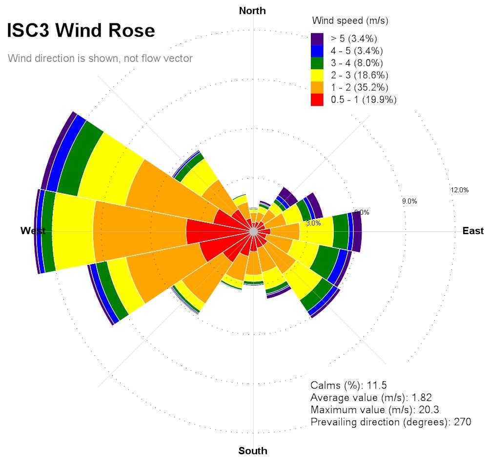
The CALMET meteorological file contains information about orography, land use, roughness length, which are not present in the single station meteorological file. Therefore additional information must be specified in the CALPUFF control file, as for example the anemometer height, the roughness length, the land use type, the elevation (a single value for the whole domain).If the single station meteorological file is in ISC3 format, it must contain flow vector, not wind direction. The wind direction is the direction from which the wind blows while flow vector is the direction towards which the wind blows, they therefore differ of 180 degrees.
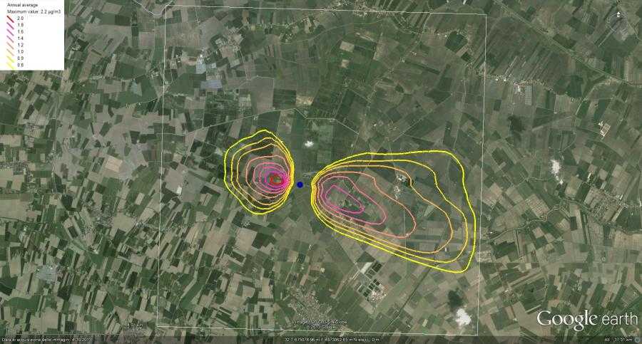
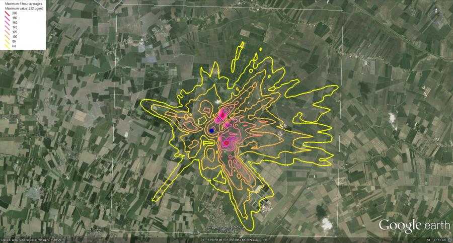
The following images show the wind rose obtained from an ISC3 meteorological input file (with flow vector rotated by 180 degrees in order to show wind direction), and annual average concentration map and maximum 1 hour average map obtained from CALPUFF. The wind rose has been created with the WindRose PRO3 software, which directly reads the ISC3 meteorological file, while the maps have been created with the GEPlot software.