WindRose PRO3
A Windows application for analyzing and plotting directional variables starting from raw data or from their frequencies.WindRose PRO is a Windows application for analyzing and plotting directional variables starting from raw data or from their frequencies. It can be used to represent wind roses, but it is also possible to represent any other directional variable. A wind rose is a chart which gives a view of how wind speed and wind direction are distributed at a particular location over a specific period of time. It is a very useful representation because a large quantity of data can be summarized in a single plot.
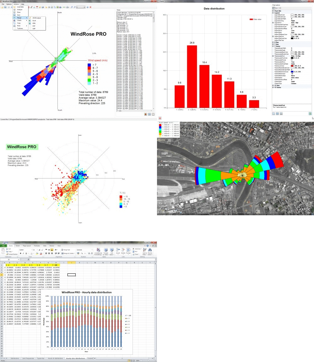
You can view here some plots generated with WindRose PRO3.
You can download and evaluate WindRose PRO3 for free.
Purchase price refers to an unlimited-time license (single platform), one year of free software updates and one year of free technical support.
Yearly maintenance renewal is needed only if the user wants software updates and technical support (including the possibility to move the license from a PC to another one).
Buy now on Fastspring secure site with your credit card, PayPal, money order, bank transfer by clicking the image below.

Discounts are available when purchasing more licenses at the same time.
Here is a detailed list of features of WindRose PRO3:
- Loads AERMOD surface meteorological files
- Loads CALMET 5.8 and CALMET 6 surface meteorological files
- Loads ISC3ST meteorological files
- Loads TD-1440 meteorological files
- Loads EnergyPlus Weather files
- Loads Typical Meteorological Year files (TMY2 and TMY3)
- Loads ASCII fields delimited files
- Loads Microsoft Excel files (XLS and XLSX)
- Loads NOAA ISH (Integrated Surface Hourly) or ISD (Integrated Surface Data)
- Loads fixed-width format NOAA ISD Lite
- Loads ASOS 1-minute data
- Loads ASOS 5-minute data
- Loads data as frequencies
- Automatically creates different types of charts
- Batch processing for creating hourly, three-hourly, seasonal and monthly wind roses
- Saves plots and charts in many raster formats (BMP, JPG, PNG, GIF, and others)
- Exports wind rose plots as DXF for CAD environments
- Exports wind rose plots as SHP (ESRI shapefiles) for GIS environments
- Exports wind rose plots as KML files for Google Earth
- Exports numerical results in Microsoft Excel format (charts built inside)
- Typical day is calculated when date and time are loaded
- Date/time filtering according to year, month, day of the week, hour of the day or day/night hours
- Possibility to read a third variable within the Microsoft Excel file
- Plots wind roses with up to 360 directions
- Plots minimum/average/maximum values
- Plots of raw data
- Plots of raw data of for the third variable
- Plots of rays
- Allows to edit and save the features of wind turbines
- Calculates circular statistics
- Calculates the theoretical wind power distribution
- Calculates the theoretical wind power distribution with a specific wind turbine
- Calculates crosswind, headwind and tailwind, and evaluates the correct orientation of a runway
- Calculates aeolian transport: drift potential, resultant drift potential, resultant drift direction
- Calculates odor separation distances with the Austrian and German empirical equations
- Calculates the wind erosion emission factors for PM30, PM15, PM10 and PM2.5
- Automatically produces a text summary of the data
- Allows to add the user’s logo on plot
- Title, legend, notes and user logo positioned with mouse dragging
- Personalised notes can be saved in Rich Text File (RTF) format
View how to create a wind rose starting from the example configuration file distributed with the installation package.
View how to create a wind rose starting from the AERMOD meteorological file.
View how to create a wind rose starting from the ISC3ST meteorological file, and how to export it as a KML file for Google Earth.